 geocatalogue.geoportail.lu
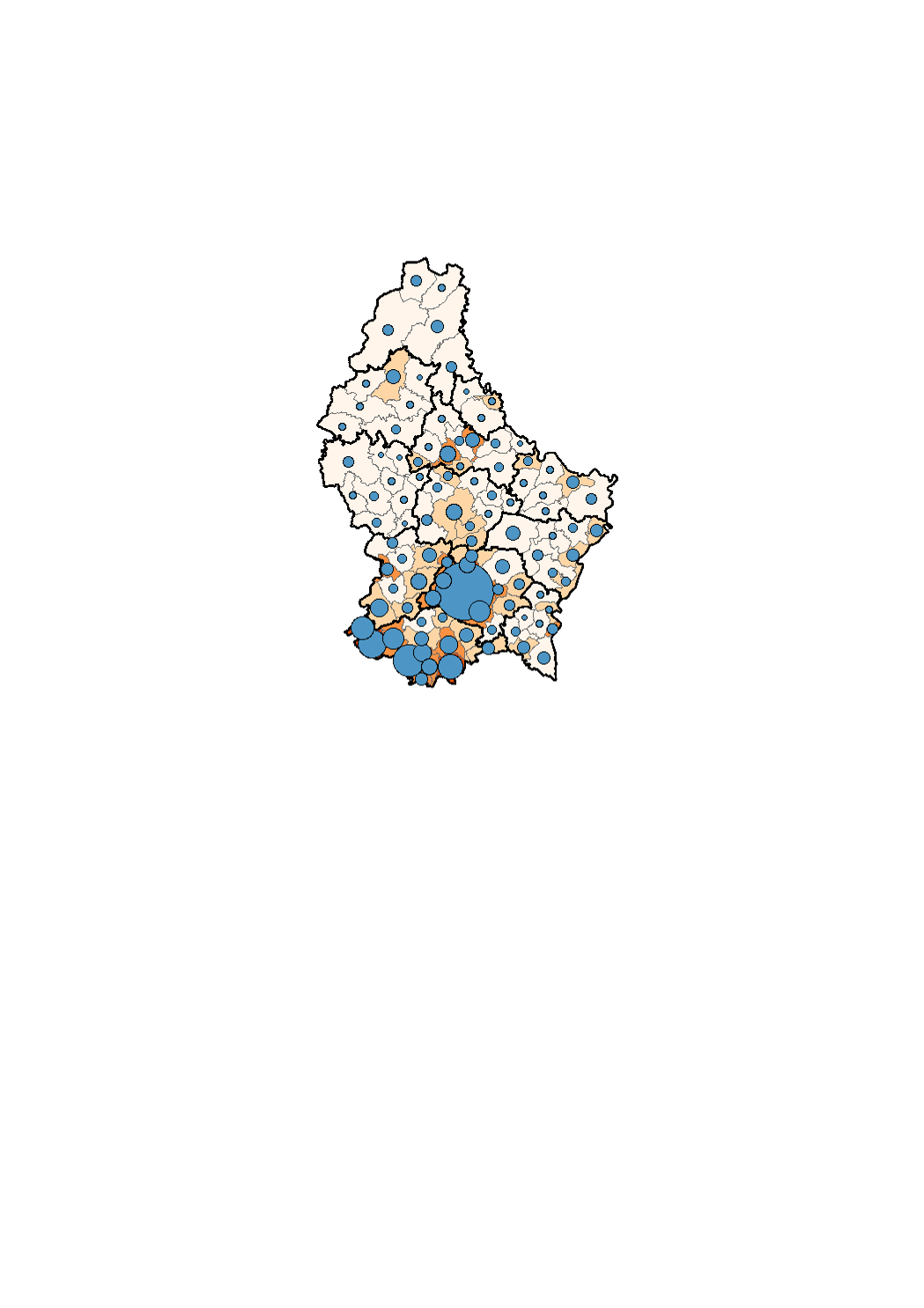
Population density per municipality on the 1st January 2018
Au Grand-Duché de Luxembourg, la densité de population a augmenté de manière continue depuis 1821. En 1821, 51.8 personnes vivaient en moyenne sur un km2 du territoire luxembourgeois. Au 1er janvier 2018, la densité de population au niveau national est de 232.8 habitants par km2. Ainsi, au cours des deux derniers siècles, la densité de population a accru de 349 %, soit elle a été multipliée par environ 4.5. <p>Définitions:</p> <p>Par densité de population, on entend le rapport entre l'effectif de la population d'une zone géographique et la superficie de cette zone. Le résultat s'exprime généralement en nombre d'habitants par kilomètre carré (hab./km2).</p>
Simple
- Citation identifier
- / 1c6bd461-d2f8-4d87-ab8e-48291eb18cbd
- Presentation form
- Digital map
- Status
- On going
- Point of contact
-
Organisation name Individual name Electronic mail address Role STATEC - Population et logement
Charlie Klein
Point of contact
- Maintenance and update frequency
- As needed
-
Entités au Grand-Duché de Luxembourg
-
-
Grand-Duché du Luxembourg
-
- Keywords
-
- Keywords
-
-
Population
-
demography
-
population density
-
geoportail.lu
-
-
geoportail.lu themes
-
-
Demographic atlas of Luxembourg
-
-
geoportail.lu structure
-
-
Demographic atlas of Luxembourg>State of population>Stock, evolution and density of the population>Population density per municipality on the 1st January
-
- Use constraints
- Other restrictions
- Other constraints
-
Creative Commons 1.0 Universal (CC0 1.0) Public Domain Dedication
- Spatial representation type
- Vector
- Denominator
- 0
- Character set
- UTF8
))
- Reference system identifier
- EPSG / http://www.opengis.net/def/crs/EPSG/0/2169
- OnLine resource
-
Protocol Linkage Name OGC:WMS-1.3.0-http-get-map
https://wms.geoportail.lu/public_map_layers/service 1535
WWW:LINK-1.0-http--link
https://data.public.lu/fr/datasets/etat-de-la-population/
- OnLine resource
-
Protocol Linkage Name https://map.geoportail.lu/theme/main?version=3&zoom=8&X=667917&Y=6394482&lang=fr&layers=1535&opacities=1 Population density per municipality on the 1st January 2018
Metadata
- File identifier
- 1c6bd461-d2f8-4d87-ab8e-48291eb18cbd XML
- Metadata language
- Français
- Character set
- UTF8
- Hierarchy level
- Dataset
- Hierarchy level name
-
dataset
- Date stamp
- 2021-02-04T23:35:06
- Metadata standard name
-
ISO 19115:2003/19139
- Metadata standard version
-
1.0
- Metadata author
-
Organisation name Individual name Electronic mail address Role STATEC - Population et logement
Charlie Klein
Point of contact
- Other language
-
Language Character encoding French UTF8 Luxembourgish; Letzeburgesch UTF8 English UTF8 German UTF8
)))