 geocatalogue.geoportail.lu
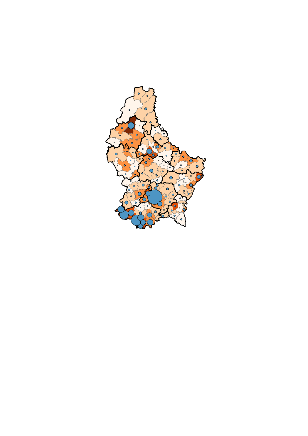
Europeans (no EU-28) in Luxembourg on the 1st January 2018
Les ressortissants de pays européens ne faisant pas partis de l'UE-28 se concentrent essentiellement dans les milieux plus urbains. Les parts les plus prononcées apparaissent dans l'ancien bassin minier au sud-est du pays, dans certaines communes de l'agglomération de la capitale, dans une partie de la Nordstad, à Wiltz et dans certaines communes rurales longeant la frontière allemande (Mertert, Grevenmacher). Ainsi, c'est à Wiltz (8.1 %), Rumelange (6.1 %) et Schifflange (5.9 %) que le pourcentage d'étrangers provenant de pays non UE-28 est le plus grand. A l'inverse, ce pourcentage est très bas dans la plupart des communes rurales des moitiés sud et nord du pays.
Simple
- Citation identifier
- / 448fb00f-a7e6-442e-bc45-4f4eb2ba57b8
- Presentation form
- Digital map
- Status
- On going
- Point of contact
-
Organisation name Individual name Electronic mail address Role STATEC - Population et logement
Charlie Klein
Point of contact
- Maintenance and update frequency
- As needed
-
Entités au Grand-Duché de Luxembourg
-
-
Grand-Duché du Luxembourg
-
- Keywords
-
- Keywords
-
-
population
-
Europeans
-
no EU-28
-
non UE-28
-
geoportail.lu
-
-
geoportail.lu themes
-
-
Demographic atlas of Luxembourg
-
-
geoportail.lu structure
-
-
Demographic atlas of Luxembourg>State of population>Foreign nationalities and place of birth>Most frequent nationalities per municipality on the 1st january 2018
-
- Use constraints
- Other restrictions
- Other constraints
-
Creative Commons 1.0 Universal (CC0 1.0) Public Domain Dedication
- Spatial representation type
- Vector
- Denominator
- 0
- Character set
- UTF8
))
- Reference system identifier
- EPSG / http://www.opengis.net/def/crs/EPSG/0/2169
- OnLine resource
-
Protocol Linkage Name OGC:WMS-1.3.0-http-get-map
https://wms.geoportail.lu/public_map_layers/service 1542
WWW:LINK-1.0-http--link
https://data.public.lu/fr/datasets/etat-de-la-population/
- OnLine resource
-
Protocol Linkage Name https://map.geoportail.lu/theme/main?version=3&zoom=8&X=667917&Y=6394482&lang=fr&layers=1542&opacities=1 Europeans (no EU-28)
Metadata
- File identifier
- 448fb00f-a7e6-442e-bc45-4f4eb2ba57b8 XML
- Metadata language
- Français
- Character set
- UTF8
- Hierarchy level
- Dataset
- Hierarchy level name
-
dataset
- Date stamp
- 2021-02-04T23:02:52
- Metadata standard name
-
ISO 19115:2003/19139
- Metadata standard version
-
1.0
- Metadata author
-
Organisation name Individual name Electronic mail address Role STATEC - Population et logement
Charlie Klein
Point of contact
- Other language
-
Language Character encoding French UTF8 Luxembourgish; Letzeburgesch UTF8 English UTF8 German UTF8
)))