 geocatalogue.geoportail.lu
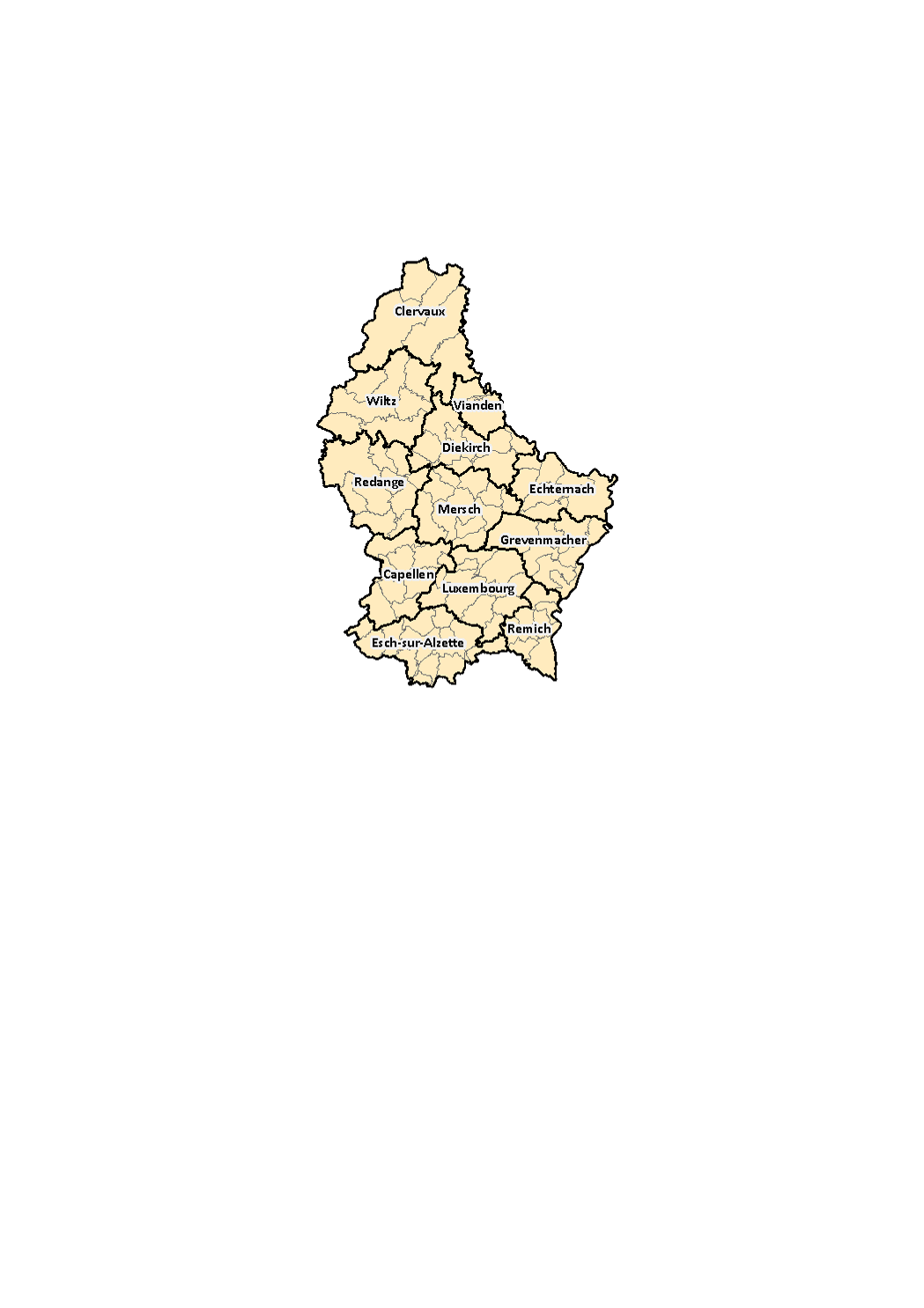
The 12 cantons and 102 municipalities on 1st January 2018
Au 1er janvier 2018, 12 cantons et 102 communes structurent le territoire du Grand-Duché de Luxembourg. Après l'abolition des districts en 2015, le canton constitue la plus grande subdivision territoriale du pays. Crées par la loi du 24 février 1843 (canton de Vianden crée en 1851), le système des cantons est cependant hérité de l'ère de Napoléon I quand le Luxembourg formait le département des Forêts (entre 1795 et 1814).
Simple
- Citation identifier
- / fbf159ad-4c67-40f4-9b40-547d1eb35642
- Presentation form
- Digital map
- Status
- On going
- Maintenance and update frequency
- As needed
-
Entités au Grand-Duché de Luxembourg
-
-
Grand-Duché du Luxembourg
-
- Keywords
-
-
Municipality, canton
-
- Keywords
-
-
geoportail.lu
-
-
geoportail.lu themes
-
-
Demographic atlas of Luxembourg
-
-
geoportail.lu structure
-
-
Demographic atlas of Luxembourg>Territorial organisation>Territoiral organisation of Luxembourg
-
- Access constraints
- Other restrictions
- Spatial representation type
- Vector
- Denominator
- 0
- Character set
- UTF8
))
- Reference system identifier
- EPSG / http://www.opengis.net/def/crs/EPSG/0/2169
- OnLine resource
-
Protocol Linkage Name OGC:WMS-1.3.0-http-get-map
https://wms.geoportail.lu/public_map_layers/service 1532
https://map.geoportail.lu/theme/main?version=3&zoom=8&X=667917&Y=6394482&lang=fr&layers=1532&opacities=1 The 12 cantons and 102 municipalities on 1st January 2018
Metadata
- File identifier
- fbf159ad-4c67-40f4-9b40-547d1eb35642 XML
- Metadata language
- Français
- Character set
- UTF8
- Hierarchy level
- Dataset
- Hierarchy level name
-
dataset
- Date stamp
- 2021-02-04T22:16:38
- Metadata standard name
-
ISO 19115:2003/19139
- Metadata standard version
-
1.0
- Metadata author
-
Organisation name Individual name Electronic mail address Role STATEC - Population et logement
Charlie Klein
Point of contact
- Other language
-
Language Character encoding French UTF8 Luxembourgish; Letzeburgesch UTF8 English UTF8 German UTF8
)))