 geocatalogue.geoportail.lu
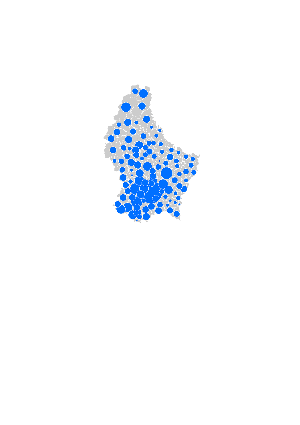
Land area used for residential prouction (2016-2022)
The land area used for residential production corresponds to the land plots which were vacant at the beginning of the observation period and on which stood a building at the end of the observation period within the residential and the mixed-used areas in the municipalities' general land use plans (PAG). Thus, only the areas on which a building was constructed (regardless of whether it includes dwellings or not) are taken into account in the land consumption, without considering the plots on which roads, car parks etc. were build. These areas were captured by comparing the orthophoto-images.
The data sources are the digitalized cadastral parcels and the orthophoto-images from the "Administration du Cadastre et de la Topographie", as well as the PAG of the municipalities.
Simple
- Citation identifier
- / 6766fa1f-26fe-402b-9f21-e3d6e903f13b
- Presentation form
- Digital map
- Status
- On going
- Point of contact
-
Organisation name Individual name Electronic mail address Role LISER
Observatoire de l'Habitat du Ministère du Logement
Point of contact
- Maintenance and update frequency
- As needed
-
Entités au Grand-Duché de Luxembourg
-
-
Grand-Duché du Luxembourg
-
- Keywords
-
- Keywords
-
-
land consumption
-
residential land
-
geoportail.lu
-
-
geoportail.lu themes
-
-
Housing
-
-
geoportail.lu structure
-
-
Housing>Land consumption / rebuilding
-
- Use constraints
- Other restrictions
- Other constraints
-
Creative Commons 1.0 Universal (CC0 1.0) Public Domain Dedication
- Spatial representation type
- Vector
- Denominator
- 0
- Character set
- UTF8
))
- Reference system identifier
- EPSG / http://www.opengis.net/def/crs/EPSG/0/2169
- OnLine resource
-
Protocol Linkage Name OGC:WMS-1.3.0-http-get-map
https://wms.geoportail.lu/public_map_layers/service 1746
WWW:LINK-1.0-http--link
https://data.public.lu/fr/datasets/superficie-des-terrains-disponibles-pour-lhabitat-en-2016/
- OnLine resource
-
Protocol Linkage Name https://map.geoportail.lu/theme/main?version=3&zoom=8&X=667917&Y=6394482&lang=fr&layers=1746&opacities=1 Land area used for residential production (2010-2016)
Metadata
- File identifier
- 6766fa1f-26fe-402b-9f21-e3d6e903f13b XML
- Metadata language
- Français
- Character set
- UTF8
- Hierarchy level
- Dataset
- Hierarchy level name
-
dataset
- Date stamp
- 2023-10-02T13:34:01
- Metadata standard name
-
ISO 19115:2003/19139
- Metadata standard version
-
1.0
- Metadata author
-
Organisation name Individual name Electronic mail address Role LISER
Observatoire de l'Habitat du Ministère du Logement
Point of contact
- Other language
-
Language Character encoding Luxembourgish; Letzeburgesch UTF8 English UTF8 German UTF8 French UTF8
)))