 geocatalogue.geoportail.lu
Exposition
Expositioun
Exposition
Exposition
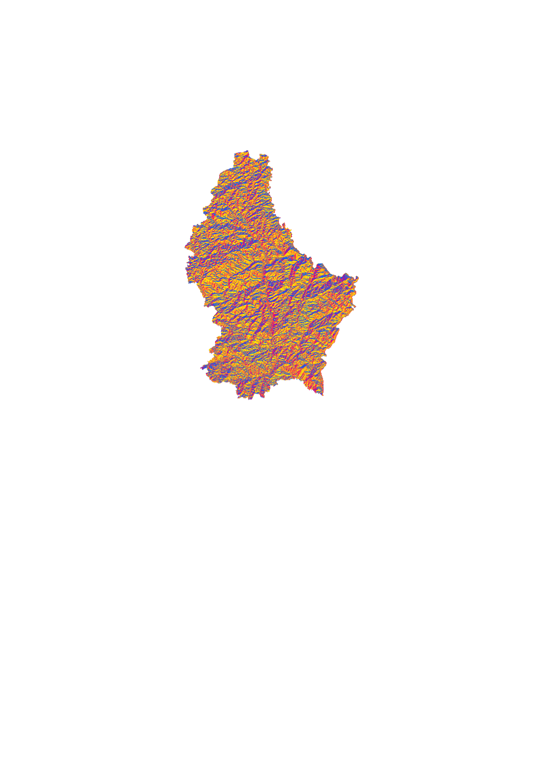
Raster d'exposition colorée basé sur le modèle d'élévation numérique de 2017. Le modèle de 2017 est basé sur une exploitation photogrammétrique d'images aériennes et a une résolution au sol de 1 m environ.
Rasterbild mat der Expositioun, deen um digitalen Héichtemodell vun 2017 baséiert. Dësen Modell ass opgrond vun denger photogrammetrescher Auswäertung vun Loftbiller entstanen an huet eng Opléisung vun ongeféier engem Meter.
Expositionsraster basierend auf dem digitalen Höhenmodell von 2017. Das Modell von 2017 basiert auf einer photogrammetrischen Auswertung von Luftbildern und hat eine Bodenauflösung von ca. 1m.
Colored exposition raster based on Digital Elevation Model from 2017. The DEM from 2017 is based on a photogrammetric exploitation of aerial images and has a ground resolution of 1 m approximately.
Simple
-
Date (Création)Date (Création)Date (Creation)Datumsangaben (Erstellung)
- 2018-06-18T00:00:00
-
IdentificateurIdentificateurCitation identifierIdentifikator
- / 7a42e4c5-6f3c-45ea-a909-3f8f28874fde
-
Forme de la présentationForme de la présentationPresentation formPräsentationsform
-
Carte numériqueCarte numériqueDigital mapDigitale Karte
-
EtatEtatStatusBearbeitungsstatus
-
Mise à jour continueMise à jour continueOn goingKontinuierliche Aktualisierung
-
Fréquence de mise à jourFréquence de mise à jourMaintenance and update frequencyÜberarbeitungsintervall
-
Lorsque nécessaireLorsque nécessaireAs neededBei Bedarf
-
Entités au Grand-Duché de Luxembourg
-
-
Grand-Duché du Luxembourg
Grand-Duché du Luxembourg
Grand-Duché du Luxembourg
Grand-Duché du Luxembourg
-
- Keywords
-
-
Exposition
Expositioun
Exposition
Exposition
-
- Keywords
-
-
geoportail.lu
geoportail.lu
geoportail.lu
geoportail.lu
-
-
geoportail.lu themes
-
-
Grand Public
Allgemeng
Main
Allgemein
-
-
geoportail.lu structure
-
-
Grand Public>Couverture du sol>Morphométrie
Grand Public>Couverture du sol>Morphométrie>Morphologie
Main>Land surface>Morphometric attributes
Allgemein>Oberflächendarstellung>Morphometrie
-
-
Contraintes d'accèsContraintes d'accèsAccess constraintsZugriffseinschränkungen
-
Autres restrictionsAutres restrictionsOther restrictionsBenutzerdefinierte Einschränkungen
-
Type de représentation spatialeType de représentation spatialeSpatial representation typeRäumliche Darstellungsart
-
VecteurVecteurVectorVektor
-
Dénominateur de l'échelleDénominateur de l'échelleDenominatorMaßstabszahl
- 0
-
Encodage des caractèresEncodage des caractèresCharacter setZeichensatz
-
Utf8Utf8UTF8Utf8
))
-
Nom du système de référenceNom du système de référenceReference system identifierIdentifikator des Referenzsystems
- EPSG / http://www.opengis.net/def/crs/EPSG/0/2169
- OnLine resource
-
Protocol Linkage Name OGC:WMS-1.3.0-http-get-map
https://wms.geoportail.lu/public_map_layers/service 1462
1462
1462
1462
https://map.geoportail.lu/theme/main?version=3&zoom=8&X=667917&Y=6394482&lang=fr&layers=1462&opacities=1 Exposition
Expositioun
Exposition
Exposition
Metadata
-
Identifiant de la ficheIdentifiant de la ficheFile identifierMetadatensatzidentifikator
- 7a42e4c5-6f3c-45ea-a909-3f8f28874fde XML
-
LangueLangueMetadata languageSprache
- Français
-
Jeu de caractèresJeu de caractèresCharacter setZeichensatz
-
Utf8Utf8UTF8Utf8
-
Type de ressourceType de ressourceHierarchy levelHierarchieebene
-
Jeu de donnéesJeu de donnéesDatasetDatenbestand
- Hierarchy level name
-
dataset
-
Date des métadonnéesDate des métadonnéesDate stampDatum
- 2021-02-04T23:48:03
- Metadata standard name
-
ISO 19115:2003/19139
- Metadata standard version
-
1.0
- Metadata author
-
Organisation name Individual name Electronic mail address Role Administration du Cadastre et de la Topographie
Service Géoportail
Point de contactPoint de contactPoint of contactAnsprechpartner
- Other language
-
Language Character encoding FrançaisFranséischFrenchFranzösischUtf8Utf8UTF8Utf8LuxembourgeoisLëtzebuergeschLuxembourgish; LetzeburgeschLuxemburgischUtf8Utf8UTF8Utf8AnglaisEngleschEnglishEnglischUtf8Utf8UTF8Utf8AllemandDäitschGermanDeutschUtf8Utf8UTF8Utf8
)))