 geocatalogue.geoportail.lu
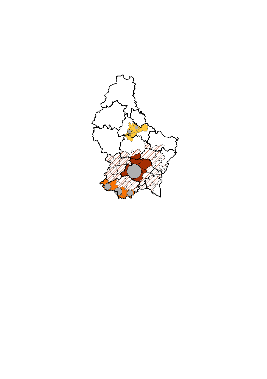
3 urban centres in Luxembourg
D'un point de vue morphologique (densité et continuité du bâti) et fonctionnel (proportion de pendulaires travaillant dans l'agglomération), le Grand-Duché de Luxembourg comporte trois grands pôles urbains, à savoir l'agglomération monocentrique de la Ville de Luxembourg et les deux agglomérations polycentriques : l'une au sud dans l'ancien bassin minier (englobant les villes d'Esch-sur-Alzette, Differdange et Dudelange) et l'autre au nord, la « Nordstad » (englobant les villes et communes de Bettendorf, Diekirch, Erpeldange-sur-Sûre, Ettelbruck, Schieren et Colmar-Berg).
Simple
- Citation identifier
- / 891c4e2b-8972-4fd7-a1aa-6330f6dafbf8
- Presentation form
- Digital map
- Status
- On going
- Maintenance and update frequency
- As needed
-
Entités au Grand-Duché de Luxembourg
-
-
Grand-Duché du Luxembourg
-
- Keywords
-
-
urban centre, agglomeration
-
- Keywords
-
-
geoportail.lu
-
-
geoportail.lu themes
-
-
Demographic atlas of Luxembourg
-
-
geoportail.lu structure
-
-
Demographic atlas of Luxembourg>Territorial organisation>Territoiral organisation of Luxembourg
-
- Access constraints
- Other restrictions
- Spatial representation type
- Vector
- Denominator
- 0
- Character set
- UTF8
))
- Reference system identifier
- EPSG / http://www.opengis.net/def/crs/EPSG/0/2169
- OnLine resource
-
Protocol Linkage Name OGC:WMS-1.3.0-http-get-map
https://wms.geoportail.lu/public_map_layers/service 1574
https://map.geoportail.lu/theme/main?version=3&zoom=8&X=667917&Y=6394482&lang=fr&layers=1574&opacities=1 3 urban centres in Luxembourg
Metadata
- File identifier
- 891c4e2b-8972-4fd7-a1aa-6330f6dafbf8 XML
- Metadata language
- Français
- Character set
- UTF8
- Hierarchy level
- Dataset
- Hierarchy level name
-
dataset
- Date stamp
- 2021-02-04T23:04:32
- Metadata standard name
-
ISO 19115:2003/19139
- Metadata standard version
-
1.0
- Metadata author
-
Organisation name Individual name Electronic mail address Role STATEC - Population et logement
Charlie Klein
Point of contact
- Other language
-
Language Character encoding French UTF8 Luxembourgish; Letzeburgesch UTF8 English UTF8 German UTF8
)))