 geocatalogue.geoportail.lu
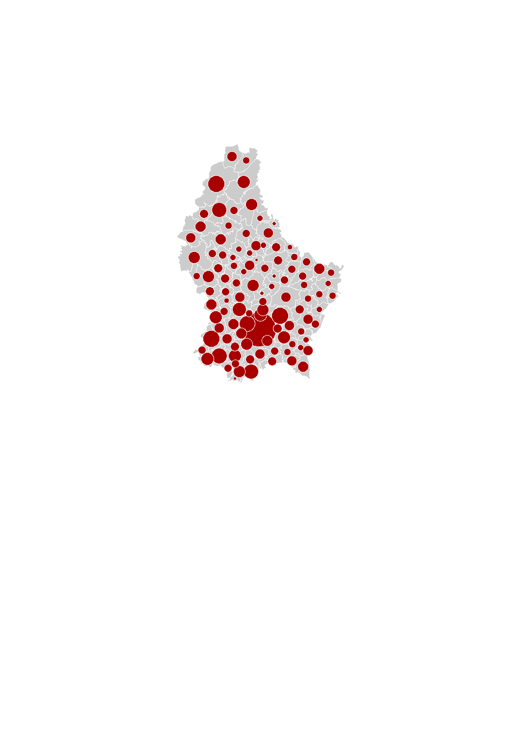
Available land area (2016)
The land available for housing corresponds to all the vacant land within the residential areas and to 75% of vacant land within the mixed-used areas in the municipalities' general land use plans (PAG) (in hectares). This is a theoretical potential, independently of the will of the owners to develop the land. The data sources are the digitalized cadastral parcels and the orthophoto-images from the "Administration du Cadastre et de la Topographie", as well as the PAG and PAP of the municipalities digitalized in collaboration with the Ministry of Interior.
Simple
- Citation identifier
- / c3fb1ec8-10d3-4e2b-9272-bb0a7396cdb5
- Presentation form
- Digital map
- Status
- On going
- Point of contact
-
Organisation name Individual name Electronic mail address Role LISER
Observatoire de l'Habitat du Ministère du Logement
Point of contact
- Maintenance and update frequency
- As needed
-
Entités au Grand-Duché de Luxembourg
-
-
Grand-Duché du Luxembourg
-
- Keywords
-
- Keywords
-
-
available land area
-
residential land
-
habitat
-
geoportail.lu
-
-
geoportail.lu themes
-
-
Housing
-
-
geoportail.lu structure
-
-
Housing>Land available for housing
-
- Use constraints
- Other restrictions
- Other constraints
-
Creative Commons 1.0 Universal (CC0 1.0) Public Domain Dedication
- Spatial representation type
- Vector
- Denominator
- 0
- Character set
- UTF8
))
- Reference system identifier
- EPSG / http://www.opengis.net/def/crs/EPSG/0/2169
- OnLine resource
-
Protocol Linkage Name OGC:WMS-1.3.0-http-get-map
https://wms.geoportail.lu/public_map_layers/service 1744
WWW:LINK-1.0-http--link
https://data.public.lu/fr/datasets/superficie-des-terrains-disponibles-pour-lhabitat-en-2016/
- OnLine resource
-
Protocol Linkage Name https://map.geoportail.lu/theme/main?version=3&zoom=8&X=667917&Y=6394482&lang=fr&layers=1744&opacities=1 Available land area (2016)
Metadata
- File identifier
- c3fb1ec8-10d3-4e2b-9272-bb0a7396cdb5 XML
- Metadata language
- Français
- Character set
- UTF8
- Hierarchy level
- Dataset
- Hierarchy level name
-
dataset
- Date stamp
- 2021-02-04T23:50:51
- Metadata standard name
-
ISO 19115:2003/19139
- Metadata standard version
-
1.0
- Metadata author
-
Organisation name Individual name Electronic mail address Role LISER
Observatoire de l'Habitat du Ministère du Logement
Point of contact
- Other language
-
Language Character encoding French UTF8 Luxembourgish; Letzeburgesch UTF8 English UTF8 German UTF8
)))